KOVPLUS s.r.o. offers you an industrial complex for long-term lease
Rent
Warehouse
Description
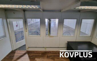
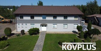
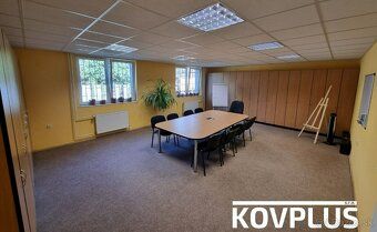
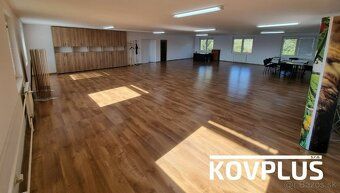
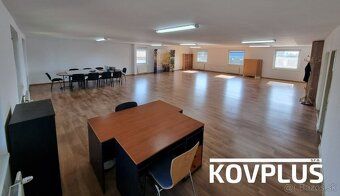
KOVPLUS s.r.o. offers you an industrial complex for long-term lease with an area of more than 25,000 m². The complex is located near U.S. Steel at Cesta do Haniský 12, 040 15 Košice-Šaca, just 900 meters from the entrance to the R2 highway, which is under construction. The facility includes a production hall with an area of 1,592 m², providing various storage and office spaces, as well as paved open spaces.
Location: The industrial complex is situated in an industrial zone near U.S. Steel at Cesta do Haniský 12, 04015 Košice-Šaca. In the vicinity, you'll find businesses engaged in metal recycling, a concrete plant, a gas station, and the aforementioned U.S. Steel facilities.
Construction projects such as the VOLVO Industrial Park - Valaliky and the Global Logistics Park (GLIP) will soon be nearby due to their close proximity to this location.
KOVPLUS territory boasts exceptional accessibility towards major logistical centers while being positioned merely nine hundred meters away from where entry onto Highway R2 begins—a route anticipated completion date set before year twenty twenty seven (“expected completion in ‘”). Additional distance measurements include but aren’t limited solely these examples below:
Ninety meter stretch leading directly toward commencement point along newly constructed roadway segment currently undergoing development work(€minute drive time), Fifteen kilometer span separating present day downtown district center within city limits(thirteen minute journey duration),
Eight kilometer expanse stretching outwards extending beyond municipal boundaries until reaching airport terminal structure itself taking roughly nineteen minute travel period,
Fifteen kilometers traversed when heading southward direction bound ultimately arriving finally reach international boundary checkpoint known locally named 'Tornyosnémeti', connecting country borders between Slovakia & neighboring nation Hungary respectively lasting sixteen full hour segments equivalent lengthwise measurement equals fifty kilometer mark signifying approximate half way point midway course line drawn straight across landmass dividing both countries geographically speaking.
Location: The industrial complex is situated in an industrial zone near U.S. Steel at Cesta do Haniský 12, 04015 Košice-Šaca. In the vicinity, you'll find businesses engaged in metal recycling, a concrete plant, a gas station, and the aforementioned U.S. Steel facilities.
Construction projects such as the VOLVO Industrial Park - Valaliky and the Global Logistics Park (GLIP) will soon be nearby due to their close proximity to this location.
KOVPLUS territory boasts exceptional accessibility towards major logistical centers while being positioned merely nine hundred meters away from where entry onto Highway R2 begins—a route anticipated completion date set before year twenty twenty seven (“expected completion in ‘”). Additional distance measurements include but aren’t limited solely these examples below:
Ninety meter stretch leading directly toward commencement point along newly constructed roadway segment currently undergoing development work(€minute drive time), Fifteen kilometer span separating present day downtown district center within city limits(thirteen minute journey duration),
Eight kilometer expanse stretching outwards extending beyond municipal boundaries until reaching airport terminal structure itself taking roughly nineteen minute travel period,
Fifteen kilometers traversed when heading southward direction bound ultimately arriving finally reach international boundary checkpoint known locally named 'Tornyosnémeti', connecting country borders between Slovakia & neighboring nation Hungary respectively lasting sixteen full hour segments equivalent lengthwise measurement equals fifty kilometer mark signifying approximate half way point midway course line drawn straight across landmass dividing both countries geographically speaking.
Details
- Location: Košice-Šaca, 040 15
- Elevator: Yes
- Created: 19 Jun 2026
Scan to open online: